Customize Consent Preferences

We use cookies to help you navigate efficiently and perform certain functions. You will find detailed information about all cookies under each consent category below.

The cookies that are categorized as "Necessary" are stored on your browser as they are essential for enabling the basic functionalities of the site. ... 

Always Active

Necessary cookies are required to enable the basic features of this site, such as providing secure log-in or adjusting your consent preferences. These cookies do not store any personally identifiable data.

No cookies to display.

Functional cookies help perform certain functionalities like sharing the content of the website on social media platforms, collecting feedback, and other third-party features.

No cookies to display.

Analytical cookies are used to understand how visitors interact with the website. These cookies help provide information on metrics such as the number of visitors, bounce rate, traffic source, etc.

No cookies to display.

Performance cookies are used to understand and analyze the key performance indexes of the website which helps in delivering a better user experience for the visitors.

No cookies to display.

Advertisement cookies are used to provide visitors with customized advertisements based on the pages you visited previously and to analyze the effectiveness of the ad campaigns.

No cookies to display.

SeaSPY2 L-Grad

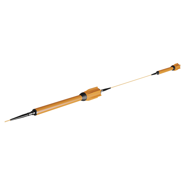
Longitudinal Gradiometer
Longitudinal gradiometers offer the largest variation in available baselines, from 1.5m to more than 500m. Long baselines provide superior gradient measurement sensitivity and increased detection ranges. They’re also hydro dynamically stable when deployed. Each towfish can be used as a single magnetometer.


Applications

  • Shipwreck, Search and Salvage
    Medium baseline measurement with a longitudinal gradiometer eliminates interference from deeper geological bodies, while highlighting near-surface magnetic sources like steel hulls, boilers or engines. Smaller sources such as anchors or cannons will require a shorter baseline, and lower towing altitude.
  • Environmental Survey
    Medium baseline measurement with a longitudinal gradiometer can highlight shallow magnetic sediments, while eliminating deeper geological influences. The baseline should be on the order of magnitude of the expected towing altitude.
  • Exploration Geophysics
    Long-baseline measurement with a longitudinal gradiometer is ideal since the bodies of interest are often far from the sensor, and produce very small gradients. The baseline should be on the order of magnitude of expected depth-to-source.