Customize Consent Preferences

We use cookies to help you navigate efficiently and perform certain functions. You will find detailed information about all cookies under each consent category below.

The cookies that are categorized as "Necessary" are stored on your browser as they are essential for enabling the basic functionalities of the site. ... 

Always Active

Necessary cookies are required to enable the basic features of this site, such as providing secure log-in or adjusting your consent preferences. These cookies do not store any personally identifiable data.

No cookies to display.

Functional cookies help perform certain functionalities like sharing the content of the website on social media platforms, collecting feedback, and other third-party features.

No cookies to display.

Analytical cookies are used to understand how visitors interact with the website. These cookies help provide information on metrics such as the number of visitors, bounce rate, traffic source, etc.

No cookies to display.

Performance cookies are used to understand and analyze the key performance indexes of the website which helps in delivering a better user experience for the visitors.

No cookies to display.

Advertisement cookies are used to provide visitors with customized advertisements based on the pages you visited previously and to analyze the effectiveness of the ad campaigns.

No cookies to display.

SeaSPY2

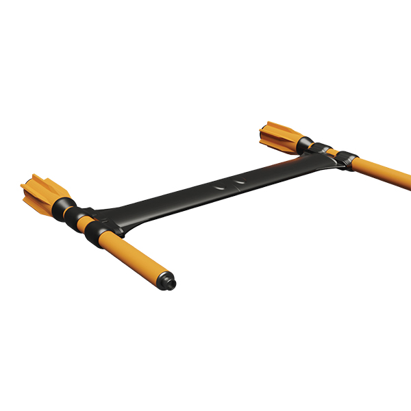
Horizontal Transverse Gradiometer v.2


Rigid frame gradiometers are best suited for short-baseline applications where relative positional accuracy is key. Each towfish can be used as a single magnetometer.


Applications

Cable/ Pipeline Survey
A horizontal transverse gradiometer can be effectively used to track cables or pipelines in real-time from relatively high towing altitudes.


The addition of vertical gradiometer data allows accurate measurement of cable/ pipeline burial depth (see SeaQuest Multi Sensor Gradiometer brochure).


Detection of Small Ferrous Targets
Short-baseline gradient, whether measured in transverse or longitudinal direction, is useful for eliminating geological and diurnal interference, and emphasizing near-surface objects in real-time so that recovery efforts can be started while the survey is in progress, rather than waiting for the Total Field data to be processed.