SonarWiz SUB-BOTTOM
Description
EXPLORE SEDIMENT LAYERS IN DEPTH, WITH REAL-TIME DATA ACQUISITION
- Signal processing features designed specifically for marine survey data
- Apply laybacks, tides, heave filters and bathymetric alignment
- Easily visualize your data in two or three-dimensions
- Support for navigation, fathometer and magnetometer data
DATA PROCESSING
Comprehensive signal processing and gain control options for sub-bottom profile data, including features designed specifically for marine surveys such as edit or inject navigation, make layback adjustments, apply tide corrections and remove heave from data. Easily apply gains and filters, correct vertical offsets and apply datum adjustments to the entire survey, then export the corrected profiles to new SEGY files or other formats for processing in 3rd party seismic or GIS software.
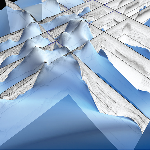
INTERPRETATION & VISUALIZATION
Quickly digitize acoustic horizons using smart reflector tracking. Distinguish horizons from multiples with the new multiple identification tool. Compare intersecting profiles directly in the digitizer or in quickly built 3D cross-profiles. Annotate your profiles with well logs to aid interpretation and perform isopach and volumetric computations on the layers you’ve identified. Easily create 3D fence plots. Generate customized reports of your work and export your corrected data to SEGY or one of the many supported GIS or CAD formats.