SonarWiz SIDESCAN
Description
INDUSTRY LEADING SIDESCAN ACQUISITION AND SURVEY MANAGEMENT
- Designed from the ground up to support towed surveying
- State of the art image processing algorithms
- Powerful contact management and reporting system
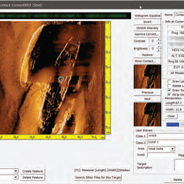
CONTACT MANAGEMENT
Extensive contact management & reporting capabilities designed to support large sidescan surveys. Pick contacts in the waterfall or plan view windows and markers will appear throughout the program. Search for contacts in other track lines or rationalize multiple contacts into a single improved target. Build database queries on 30+ automatic and user-defined data fields. Update contact data when survey navigation is modified in post-processing. Export contacts as georeferenced images, MS Office reports, or GIS layers.
DATA ACQUISITION
Lay out your lines and estimate survey timing with SonarWiz survey planning tools and send the plan to the remote helm display. Acquire sonar, navigation, fathometer data, payout meter and magnetometer data
simultaneously. Configure the real time display options to display just the data you want, including sidescan and subbottom waterfalls, contact target strips, and fully processed, real-time mosaics
POST PROCESSING
Powerful tools for correcting the navigation of towed sensors include manual editing & filtering, post-process navigation injection, & map corrections to multibeam ground truth. Advanced gain & signal processing filters to enhance target detection or prepare a sidescan survey for habitat classification. The Seabed Characterization Tool can segment acoustic imagery into homogeneous regions for sediment classification. Export corrected data to XTF or one of many supported GeoReferenced Image, GIS and CAD formats