MagEx Portable Exploration Magnetometer
Description
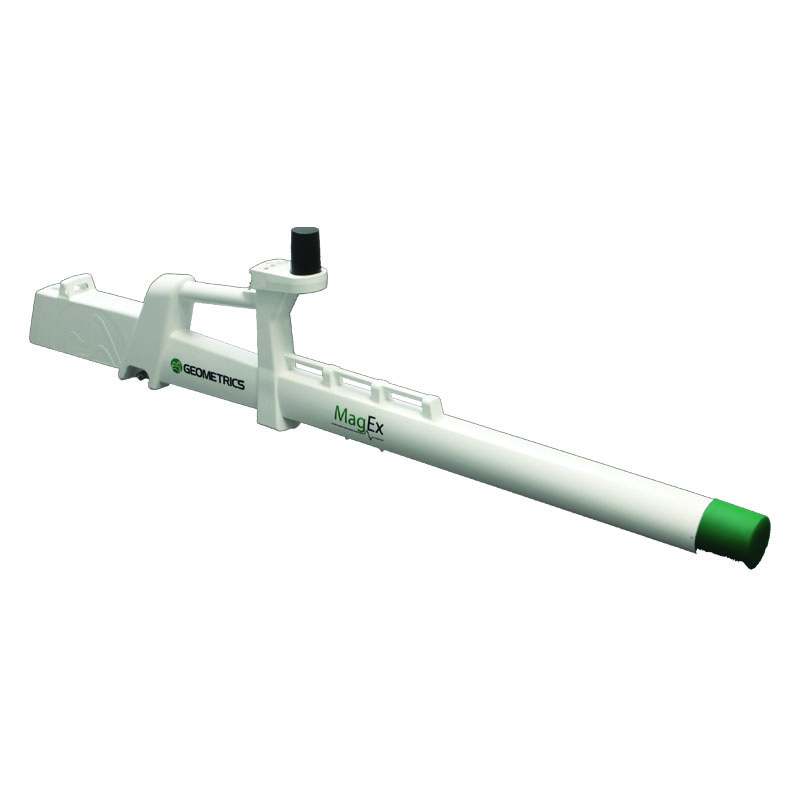
The MagEx is the newest, lightest, and most advanced land magnetometer in the Geometrics product line. Completely designed around our MFAM sensor, the MagEx is fully self-contained with GPS, data storage, and its own wireless access point on-board, allowing for a more modern user experience. The system will run for 12+ hours (at room temperature) on a fully charged battery. At only 3.7 kilograms (about 8 pounds), this well-balanced instrument is comfortable to use in all types of terrain and the most inhospitable conditions.
The user interface software, MagNav, has modern features such as real-time viewing of the magnetic field data, waypoint navigation with Mapped Surveys, and the ability to grid data and create a color contour map while in the field. These features allow users to be confident in their data and help ensure they have what they need once they return to the office. Once the survey is complete, the data is transferred from the tablet to the field computer for further analysis.
The new MagEx fits today’s market – a lightweight design for easier portability, Android-tablet compatible to eliminate bulky data loggers, and low-powered for extended battery life. The system’s wireless controls eliminate the well-known hassle that cables can cause while in the field. The MagEx is unlike anything we’ve offered before.
