MarinePak7
Description
Marine-certified enclosure delivers scalable positioning solutions
OEM7 GNSS technology
Based on proven OEM7 technology by Hexagon | NovAtel, the MarinePak7 can receive GPS, GLONASS, BeiDou, Galileo and QZSS signals. Multiple GNSS signals deliver better satellite availability and reduce the impact of satellite masking or blockage which can affect positioning. It also receives L-Band signals on multiple channels providing access to the world-wide corrections provided by Oceanix.
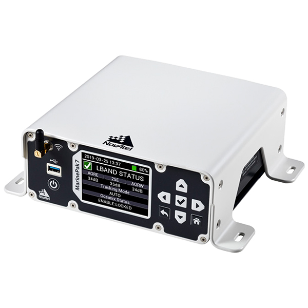
Simple to configure and operate
The color display and intuitive navigation menu makes setup, configuration and system status monitoring simple. The display also helps troubleshoot issues with the MarinePak7 allowing faults to be quickly diagnosed and resolved. Users can also connect to the receiver using the on-board Wi-Fi and use the Web UI to configure and monitor the system.
GNSS+INS integration
SPAN GNSS+INS technology combines GNSS positioning with inertial navigation system (INS) measurements including velocity, attitude and heave. In a solution optimized for hydrographic survey applications, the 3D positioning provides accurate measurements even through extended GNSS outages.
Scalable solution
As your requirements change, the MarinePak7 provides a scalable solution to enable additional features when you need them. ALIGN technology by NovAtel is optionally supported when combined with a second antenna to provide a GNSS heading solution. The removable battery option allows users to work anywhere without a direct power supply connection or it can be used to bridge power outages. The UHF model can be used as a data link to receive RTK corrections which can also be received via the GSM/GPRS modem. For more demanding applications, data logged on the receiver can be downloaded for post-processing using NovAtel’s GrafNav software.
